The modern world of architecture and construction is hectic, and based on its speed, it is no longer enough to draw sketches and blueprints and leave them at that. Before the first brick is laid, homeowners, investors and developers would like to see what they had envisioned to actualise it. That is where renders and mapping tools come in with a revolutionary role.
Whether it is a residential building, an office building, or a renovation, advanced digital tools enable designers and constructors to produce more innovative designs, communicate more effectively, and make informed decisions. ZA Builders Pakistan experienced the power of these tools to take the projects to a new level beyond the ordinary. Now we are going to get to know the best 5 advantages of applying renders and mapping tools in architecture.
1. Visualizing the Final Outcome
The ability to bridge the gap between imagination and reality is one of the biggest challenges in construction. Clients may struggle to interpret traditional drawings, as they can decipher the layout but not the appearance and atmosphere of the resultant space.
Renders, such as 3D and photo-realistic models, enable you to:
- Take a look at the building at various angles prior to construction.
- Visualise realistic colours, textures and materials.
- Know how natural light can be used in various spaces during daylight hours.
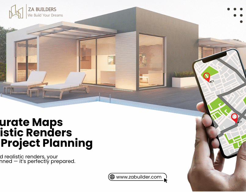
Mapping tools, in their turn, can give the proper spatial context. They provide the way your property is located in the area, access to roads, terrain and the neighbouring buildings.
To the homeowners in Pakistan, particularly in such cities as Karachi, Lahore and Islamabad, this translates to fewer surprises, better decisions, and a clear understanding of what your investment will look like and how it will operate.
2. Better Planning and Accuracy
Without proper planning, it is easy to get off-track with construction projects. Renders and mapping software assist planners in architecture and engineering to plan with precision:
- Mapping tools produce accurate site layout, topography maps and land surveys. This will see to it that foundations, walls, and utilities are placed properly.
- 3D renders enable designers to preview spatial layouts, ratios, and experiment with layouts in a computer.
With this degree of accuracy, expensive errors, rework and unnecessary materials will be minimized. This implies to the homeowners to be on budget and avoid the delays that are the main pain areas in construction projects.
3. Improved Stakeholder communication
In construction projects, several parties are usually involved consisting of architects, contractors, engineers, interior designers, the client to mention but a few.
- Miscommunication leads to mistake, latitude or disappointment.
- The mapping and rendering tools provide the universal language:
- Instead of interpreting 2D drawings, clients can see exactly what is planned.
- Visual issue: The builders and contractors can rely on visual indicators to translate designs to precision.
- The engineers can detect any structural/spatial challenges before constructions start.
This would bring everybody to the same page, thus enhancing collaboration and reducing misunderstanding. In a country like Pakistan, where construction projects can easily get delayed due to a lack of coordination, such tools are essential.
4. Refining and personalisation
One of the most interesting functions of renders is the possibility to play without losing anything. Want to see where marble flooring can be applied when paired with dark cabinetry? Wondering how it came to have a skylight in the living room? Considering a refresh of the facade colour?
Using 3D renders:
- You can test a variety of design options in no time
- Clients will be allowed to provide feedback after seeing real-looking visuals instead of ideas.
- Architects can plan layouts optimally with respect to aesthetics, comfort and functionality.
Mapping tools enhance this by illustrating the impact that such changes have on the entire site plan, the surrounding area, and/or site accessibility. This tailorability ensures that the end result is a design that perfectly corresponds to the client and their lifestyle.
5. The chase of marketing and investor aspects of confidence
- Great mapping imagery and renders aren and are not just about design, it is about power marketing also.
- The developers in the real estate business have the opportunity to display images of properties in photo realistic details online.
- Investors are able to know what exactly they are investing by having a clear picture of the project, which boosts their confidence.
- Before construction work begins, homeowners are able to make informed decisions because they will not have any regrets.
In the competitive real estate market of Pakistan, rendering and maps of the project with professional quality tend to endear the project to the buyers and investors sooner. Presented properties appear professional, reliable and have a keen eye on detail, which are traits that buyers cherish.
Bonus: Sustainability and Energy Planning
State-of-the-art renderings can also emulate natural lighting, air circulation, and energy ratings, allowing architects to design environmentally friendly and energy-efficient buildings. Mapping tools are used to depict terrain, water flow and ideal position of the solar panel.
- The integration of technology is guaranteed by it being:
- Lower cost of energy to the homeowners.
- Smart, more sustainable builds.
- Long-term increase in the value of the property.
ZA Builders Pakistan = Making Designs to Reality.
ZA Builders unites traditional construction knowledge with digital tools. The use of renders and mapping tools looks as follows:
- Precise 3D renders enable homeowners to see all the rooms, exteriors and landscapes.
- Mapping tools also facilitate correct site design and structural alignment of the infrastructure.
- The collaborative type ensures the alignment of the clients, engineers, and contractors in every step.
- Cost effectiveness through ecological wastage of the materials and elimination of construction mistakes.
Our combination of these technologies can allow homeowners in Pakistan to realise functional, beautiful, and high-value homes, without most of the stress and surprises we are used to.
Final Thoughts
The availability of renderers and mapping software has transformed the architecture. They bring ideas out of the abstract world into something concrete and visual, enhance planning, boost communication, and ultimately add value and functionality to any property.
The use of these tools is not only a luxury, but also a wise choice that saves homeowners, developers, and investors in Pakistan unnecessary time, money, and frustration. It also gives you peace of mind that the result of your design and construction is what you thought of precisely, from the point of drawing the first lines on the paper to the receipt of the keys to the property.
ZA Builders Pakistan has brought its technical expertise and state-of-the-art equipment to help realise your vision of creating a dream home, renovating a villa, or developing a commercial property.
Nobody denies that a properly designed property is not just a place to live, but rather an investment in comfort, usability, and future value.